Three Tree Point, Burien, WA
 |
An inverted black and white version of a map created in April, 2008. ©Scott Okumura
|
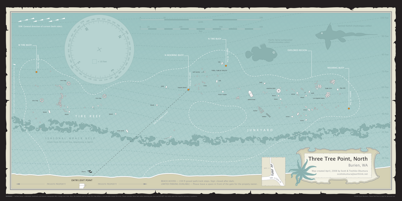
This is a map that was created as a requirement for both of our PADI Divemaster certifications. It is the first dive map that Toshi and I have created. It took a dozen dives to complete over the course of two months. The area marked by the dotted line indicates the region that we explored on those dives. We have since visited the site nearly a hundred times and have explored well outside of the area that we mapped but we have not attempted to update the map.
In retrospect, Three Tree Point was an ambitious choice for a first attempt at mapping. It's a huge site if you want to include every attraction and there are large areas without objects to plot, making it a challenge to connect everything.
Our strategy was to plot stable mooring buoys first, then fan out from them in all directions, double-checking certain measurements on each subsequent dive until the separately plotted regions could be overlapped and joined together.
While working to produce this map, I learned that the best season for plotting objects is in the winter months, before the wrack kelp grows in the shallows. It conceals objects and fouls the knotted line used to measure and it doesn't subside until late in the fall (November.)
 |
A close up of the Tire Reef, directly west of the trail that leads to the beach. ©Scott Okumura
|
There is a small cabin cruiser that can be found to the southwest in about 75 fsw. It's fairly isolated and we managed to miss it on two attempts while working to complete this map. We have since pinpointed it and I would like to include it in a revision of the map. Unfortunately, it will greatly increase the width of the map since it is nearly 300 feet in that direction.
 |
A close up of the Junkyard, northeast of the entry point. ©Scott Okumura
|
The area we call the Junyard extends down the slope and well beyond the dotted line marking the area that we plotted for the map. There is a large bottle field below 100 fsw in a due north direction. Storms have uncovered objects that were buried when we made our map and there are several large logs on the upper slope (between 30 and 40 fsw.)
 |
This is the original full color map created in April, 2008.
Download a high-resolution pdf here. ©Scott Okumura |
 |
| Spotted Ratfish (Hydrolagus colliei) — often seen in great numbers here. ©Scott Okumura |